
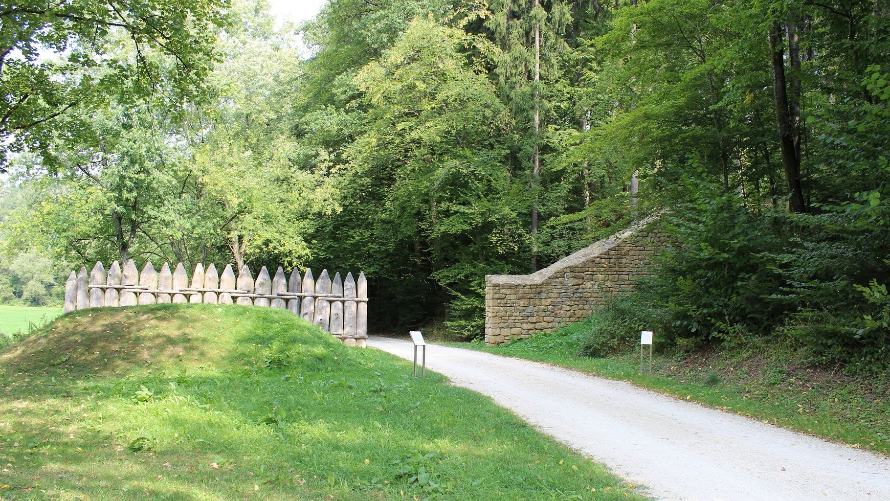
Entrance Rotenbachtal
© Verein Deutsche Limes-Straße
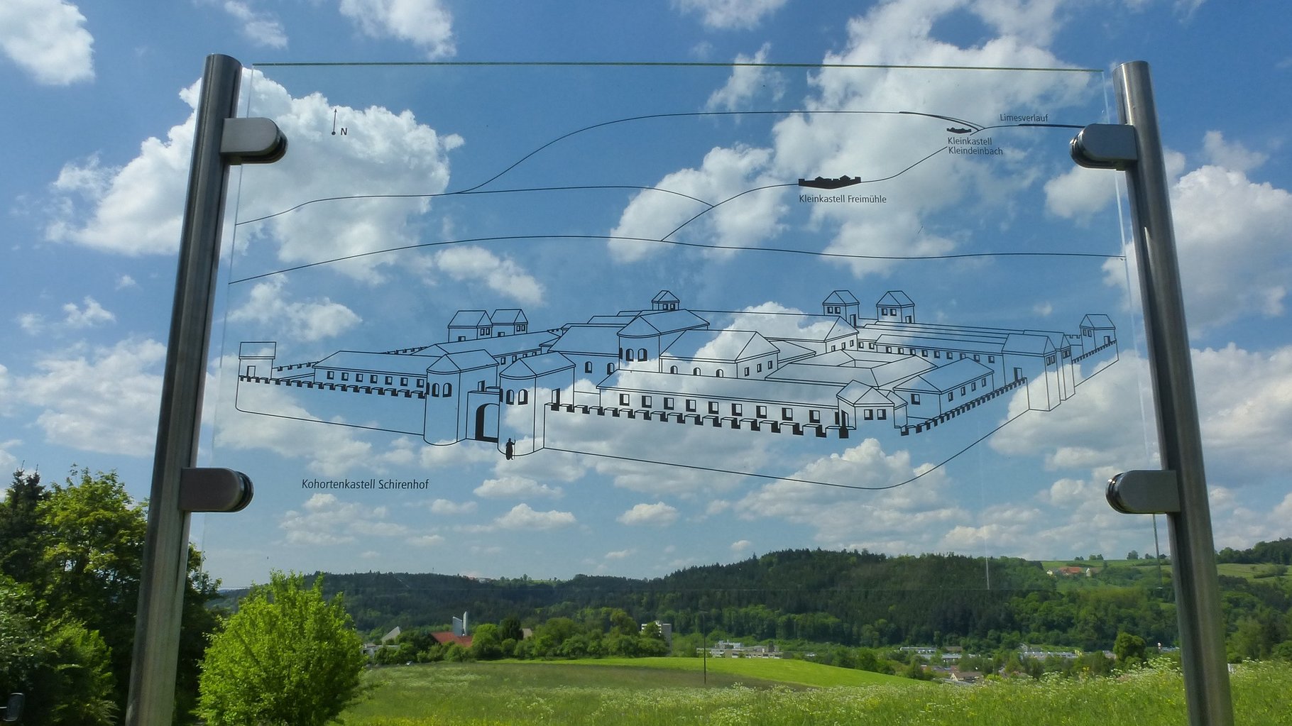
Cohort Fort near Roman Bath Schirenhof
© Touristik und Marketing GmbH Schwäbisch Gmünd
Limes in the Taubental
© Touristik und Marketing GmbH in Schwäbisch Gmünd

Roman Exhibition in the Museum Schwäbisch Gmünd
© Touristik und Marketing GmbH Schwäbisch Gmünd
The Remstal valley was, from 160AD until 260AD, the outermost border of the Roman Empire. On the northern slope of the valley runs the Limes. The area around Schwäbisch Gmünd was controlled by 1500 soldiers, who were organised in cohorts and stationed in Schwäbisch Gmünd. On the western hillside of the Rotenbach valley, on the inner border between the Roman provinces of Upper Germania and Raetia, a noticeable change in the construction is visible. Here the Raetian wall and rampart meet the Upper Germanic palisade fence. The reconstruction of the inner border can be seen in the Rotenbachtal. The Raetian part of the Limes was controlled by the infantry fort at Freimühle just along the provincial border. Directly below the fort runs the most important military road through the Remstal valley, coming from Lorch and crossing the river at the level of the Schirenhof fort.
Medieval town centre with late Gothic Johannis-Church, Heilig-Kreuz-Minster, Augustinus- Church, Franziskaner-Church, silverware factory Otto Pauser. Museum in the “Prediger”

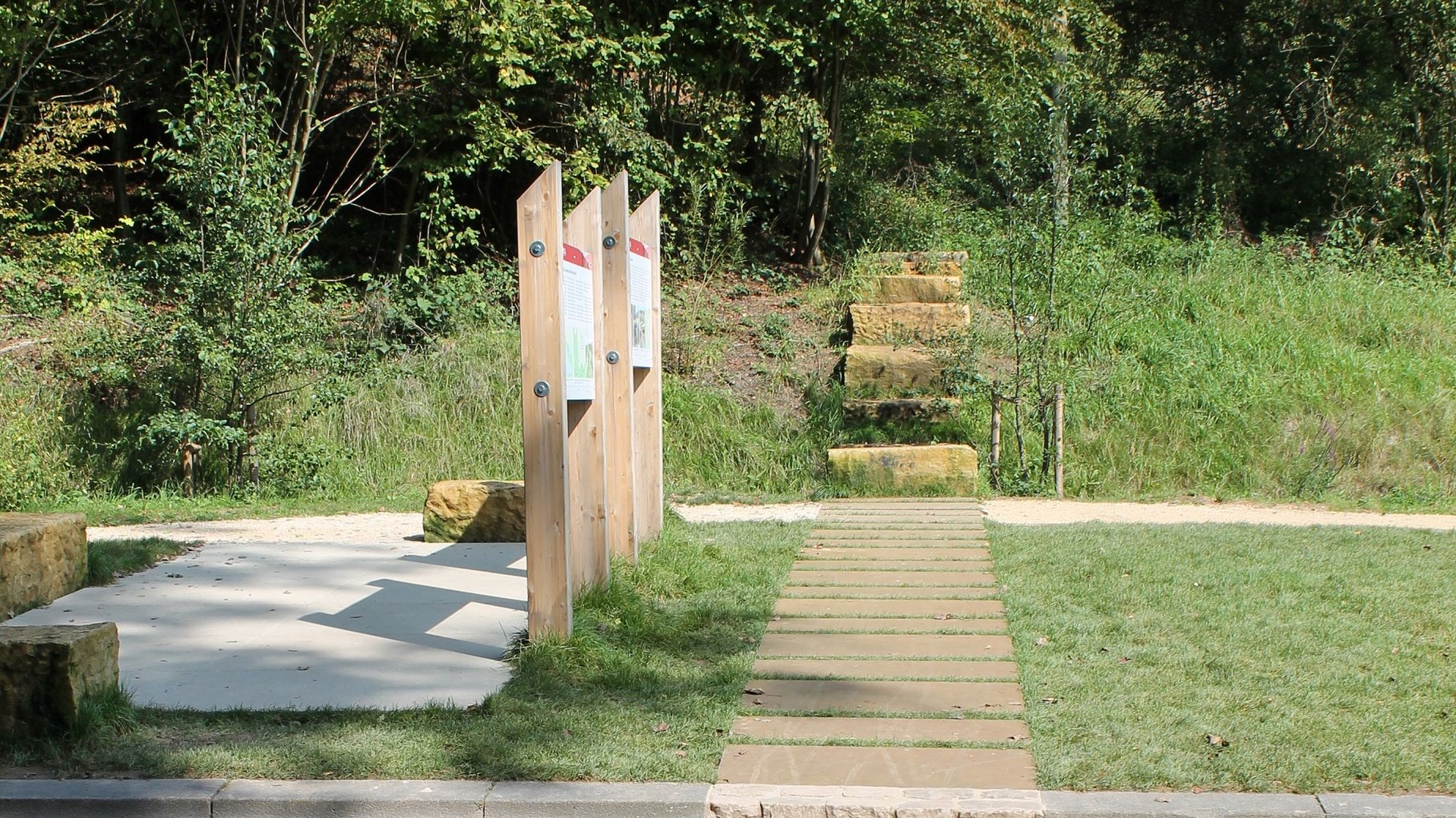
Along this walk the visitor can experience this unique border situation. The walk takes approximately three hours, and the monuments of the western Raetian cohort fort of Schirenhof Schierenhof and the Rotenbachtal valley can also be explored. The signpost with the Roman helmet leads you on your trip from Schirenhof to the Rotenbachtal. Parking is available at Schirenhof as well as at the entrance to the Rotenbachtal.

Special attention deserves to be paid to the Limes information centre at the entrance to the Rotenbachtal valley. In the information pavilion you can find a model of the landscape which provides information about living and working in Roman times along the Limes. Through information panels and the models of the forts, you can gain an insight into the Roman past of Schwäbisch Gmünd. The reconstruction of a Roman milestone highlights the distance between Schwäbisch Gmünd and important towns in the Roman Empire. About 900 metres from the information pavilion, on the western hillside above the Rotenbach stream, lies the beginning of the stone Limes in Raetia, still easily discernible.

Cohort fort Schirenhof: the remains of a Roman cohort fort are hidden underneath the meadow of the Schirenhof at the northern end of an elevated tongue of land which protrudes into the Rems valley. The fort was built in the middle of the 2nd century A.D. and left towards the middle of the 3rd century. Visible: foundation walls of the completely excavated bath house of the Fort Schirenhof; not far from the location of the fort’s bath house, which can be looked at through a Plexiglas pane.

In its Roman section, the Museum im Prediger presents finds from the Schirenhof fort, the baths and the cemetery near the Schirenhof. Originals, replicas and reconstructions convey a vivid picture of Roman life.
Address: Museum im Prediger
Johannisplatz 3, 73525 Schwäbisch Gmünd, Telefon +49 (0) 7171-603 4130.

Fort baths were among the permanent facilities at the troop locations. They were used for recreation and personal hygiene. They were also open to the inhabitants of the fort settlements, as numerous recovered toilet utensils and women's jewellery prove.
The complex at Schirenhof was built together with the fort around the middle of the 2nd century AD and was subsequently rebuilt and extended several times. After 233 AD, the building was apparently reduced in size and reduced to its most important functions before the baths were completely abandoned after 248 AD.
The city of Schwäbisch Gmünd had the foundation walls of the bath restored in 1975 and opened it to the public; in 1999 it was renovated from the ground up.
At the eastern end of the Upper Germanic Limes, which was commanded from the provincial capital of Mainz, lay the small fort of Kleindeinbach - about 50 m behind the Limes palisade. It belongs to the category of field guards in which no independent military garrison was stationed. Presumably, its garrison of about 20 soldiers was part of the force located in neighbouring Lorch. At the beginning of the 19th century, the building remains of this small fort were levelled. The fort can be reached via the circular hiking trail. No traces are visible above ground; an information board provides information about the site.

The fort of Freimühle is located on the hilltop in the Vogelhau forest. The fort was the westerly troop station in the province of Raetia. The 55m x 55m fort was examined by the Reichslimeskommision in 1902. A trapezoidal turret at the corner of the fort and simple gates in the east and west sides were uncovered. Approximately 50m south east from the fort was a bath house. The fort had strategic importance, as it was located near the provincial border as well as the Roman military road through the Remstal valley. Special attention should be given to the Limes information centre at the entrance to the Rotenbachtal valley near the Freimühle fort. An information pavilion with a model of the landscape provides information about living and working in Roman times along the Limes. Close to the pavilion is a reconstruction of the different types of border fortification of the Roman provinces of Upper Germania and Raetia, with wooden palisade fence and rampart and ditch. The Raetian frontier is also known here as the Devil’s Wall. The information panels give an insight into the Roman past of Schwäbisch Gmünd. The reconstruction of a Roman milestone highlights the distance between Schwäbisch Gmünd and important towns in the Roman Empire.

Attention is drawn to the World Heritage Site at another prominent location in Schwäbisch Gmünd. Information with clear markings and reconstructions of the Raetian Limes were created in 2014 at the entrance to the Taubental recreational forest, a ten-minute walk north of Schwäbisch Gmünd main station, along the course of the Limes. In the ground, the remains of the Roman boundary are still present today. Above ground, sandstones can now be seen on both sides of the road and the accompanying walkway. The adjacent information square is covered with sandstone slabs and block ashlars invite visitors to linger here. Panels with texts and graphics provide information about the significance of the border. The Limes was reconstructed by means of a strip of historical paving. All elements have a width of 1.20 metres - exactly the width that the Roman border fortifications had there.
i-Punkt Schwäbisch Gmünd
Marktplatz 37/1
73525 Schwäbisch Gmünd
Tel. +49 (0) 71 71 / 603 4250
tourist-info@schwaebisch-gmuend.de
www.schwaebisch-gmuend.de
Türlensteg 9
73525 Schwäbisch Gmünd
Tel.: 07171/3590
info@hotel-pelikan.de
www.hotel-pelikan.de
Remspark 1
73525 Schwäbisch Gmünd
Tel.: 07171 7988200
info@hotelamremspark.de
www.hotelamremspark.de
Rinderbachergasse 10
73525 Schwäbisch Gmünd
Tel.: 07171 /1046990
hotel@einhorn.gd
www.einhorn.gd
Hauberweg 4
73525 Schwäbisch Gmünd
Tel.: 07171/1090
fortuna-gmuend@fortuna-hotels.de
www.hotel-schwaebisch-gmuend.de
Hochstraße 7
73525 Schwäbisch Gmünd
Tel.: 07171/8094472
info@pension-koenigsturm.de
www.pension-koenigsturm.de
Remspark 2
73525 Schwäbisch Gmünd
Tel.: 07171 877390
willkommen@villa-hirzel.de
www.villa-hirzel.de
Schießtalstraße 1-3
73527 Schwäbisch Gmünd